
Jackson Township ZIP Code Coverage
The documented ZIP evidence is deliberately partial. Auditor parcel profiles verify that three postal labels serve at least part of Jackson Township’s tax-district geography. They do not draw complete United States Postal Service boundaries or prove that every address in a ZIP lies in the Township. Treat the entries below as verified starting points. Use the full address in USPS and then consult the Auditor, Parcel Viewer, Engineer, and Township maps before assigning a government jurisdiction.
| ZIP | Areas Covered | Post Office | Notes |
|---|---|---|---|
| 43123 | At least the Hoover Road, Grove City-addressed portion documented in Jackson tax district 160 | Grove City | Township administration and Fire headquarters use this postal label; not a complete boundary. |
| 43228 | At least the Alkire Road and Salem Heights sample portion in tax district 160 Jackson | Columbus | Shows a Columbus postal label alongside Jackson Township tax-district evidence. |
| 43137 | At least the southern Hibbs and Hiner-area sample portion in tax district 160 Jackson | Lockbourne | Verified by the Hibbs Road Auditor example; not a whole-ZIP claim. |
No authoritative static source found during research lists all ZIPs or publishes a complete Township-wide USPS boundary. USPS verifies one address at a time. That is more precise than extending a nearby postal city label across a whole road or subdivision.
Jackson Township Postal Geography
Jackson Township is a Franklin County civil township in the Grove City area, not a city defined by a single mailing name. Its administration uses a Grove City 43123 postal address, while official parcel examples also show Columbus 43228 and Lockbourne 43137. Postal city, municipal tax district, and civil township can coexist on one official property profile. None automatically replaces the others.
That overlap changes the record path. A postal label tells mail carriers how to route an address. A civil-township name identifies a unit of local government. A tax district and annexation layer help place a parcel for county purposes. The Franklin County Engineer holds Township maps, road records, plats, historic maps, and unincorporated-address assignments, so it is a better geography fallback than guessing from a ZIP code directory alone.
Verify Jackson Township ZIP Codes
Use the USPS ZIP Code Lookup to test an individual delivery address. Enter the complete street address rather than assuming that a familiar postal city fixes the ZIP. After USPS returns the postal result, compare the same street address with the Auditor’s parcel profile and the Parcel Viewer. If the government geography is still unclear, check the Engineer or a Township zoning map. This sequence separates delivery information from the maps that support a records request.
USPS address-by-address ZIP verification is the appropriate lead source for the Jackson Township ZIP code directory.
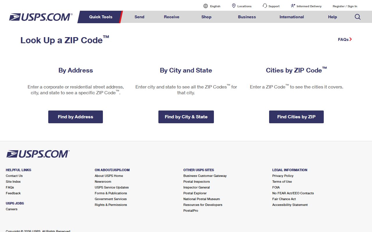
The result confirms postal handling for the entered address. It does not label a property’s civil township, tax district, or annexation status.
Jackson Township ZIP Code Records
A ZIP code can organize a search, but the documented county property forms do not provide a public ZIP field. The practical sequence is address first, parcel second, records third. Once the parcel is identified, its legal description and tax-district context can carry the search across Auditor, GIS, Treasurer, and Recorder tools. For a named street after that work, the Jackson Township street directory covers the address-keyed record chain in more depth.
- Verify the full mailing address with USPS and retain the returned ZIP and postal city as postal facts.
- Search the Auditor by street number, direction, street name without a suffix, and unit when available.
- Open the parcel profile and save the parcel ID, site address, legal description, and tax district separately.
- Use the Parcel Viewer’s map layers for annexation, special tax district, subdivision, or parcel context.
- Search the Recorder by a documented party, document number, or legal description if a dated recorded-document question remains.
Ohio voter tools are not a substitute for this sequence. The county and statewide lookup routes support limited registration, polling, and geography questions; they do not create a ZIP-wide or streetwide census.
Jackson Township Auditor ZIP Gap
The public basic Auditor forms accept owner name, street address, parcel ID, subdivision or condominium, advanced criteria, and map modes. Their documented address fields are Street No, Direction, Street Name Only, and Unit. The owner form permits a partial name or wildcard. Parcel-ID search accepts all or part of an ID without dashes. No basic owner, address, or parcel form exposes a ZIP input, and research found no verified ZIP-wide property filter.
| Auditor field | Documented use | ZIP code role |
|---|---|---|
| Street No / Direction / Street Name / Unit | Address search; omit the road-type suffix | Not an input field |
| Owner Name | Last-name-first or partial-name property search | Not an input field |
| Parcel ID | All or part of the no-dash identifier | Not an input field |
| Advanced criteria | At least one selected real-property criterion | No verified ZIP filter documented |
Use the ZIP as an address-verification detail, then move through street, parcel, legal-description, annexation, and tax-district data. That avoids promising a filter the County has not published.
Jackson Township Parcel Examples
Three Auditor profiles make the postal overlap concrete. The 43123 Grove City example shows Jackson tax-district and Township evidence on Hoover Road. The page is a sample parcel profile, not proof that every 43123 address is in Jackson Township.
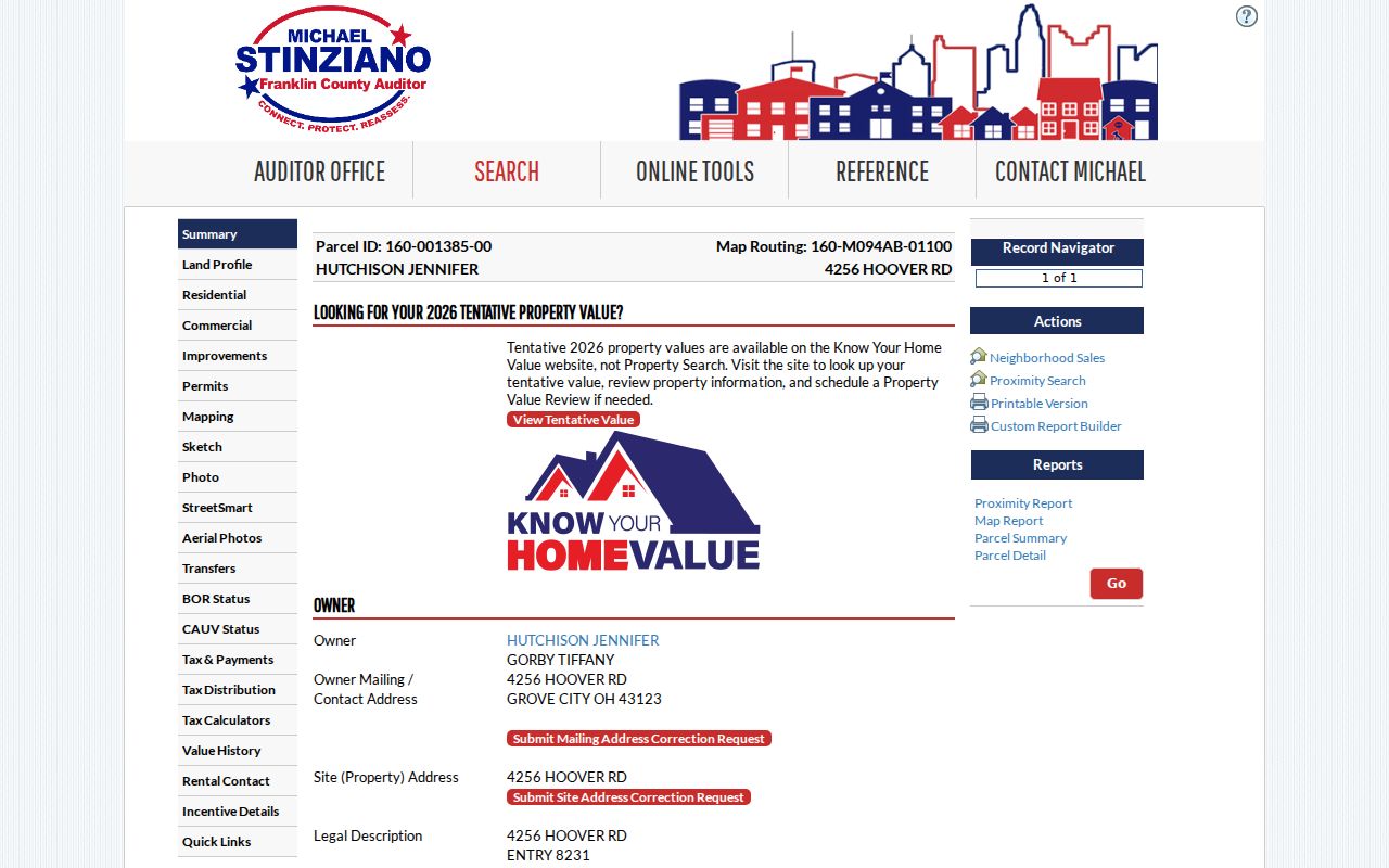
Read the profile’s postal, tax-district, Township, site-address, and legal-description fields separately before using it for records geography.
The 43228 Columbus example is the Salem Heights and Alkire Road evidence for Jackson tax district 160.
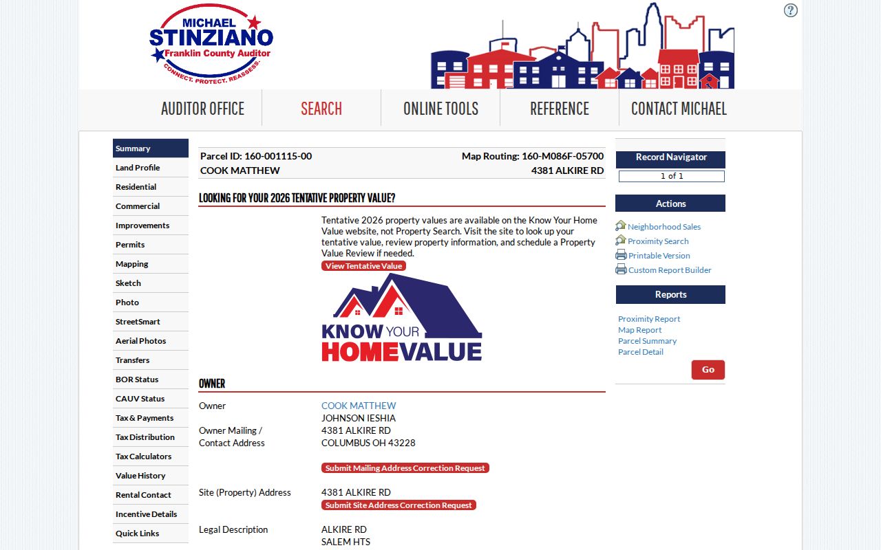
Its Columbus postal label does not prevent the parcel from carrying Jackson-related county geography.
Jackson Township Lockbourne ZIP Evidence
The 43137 Lockbourne Auditor example documents the Hibbs Road sample in tax district 160 Jackson. It supports only the careful conclusion that 43137 serves at least part of the Township’s documented property geography. An individual nearby address still needs USPS and parcel verification.
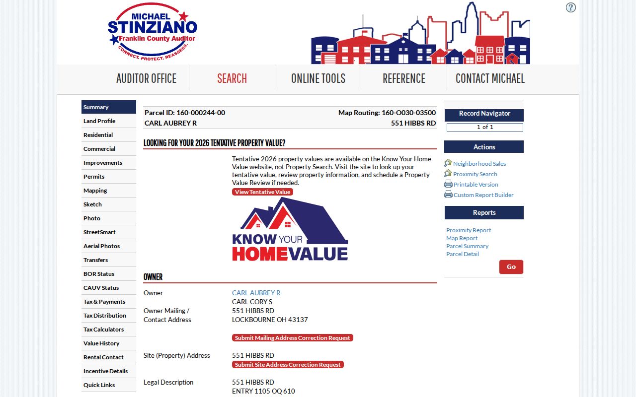
Keep the parcel ID and legal description with the postal result when a deed, tax, or jurisdiction question may continue over time.
Note: ZIP labels can guide an address search, but map and parcel fields determine the stronger county record trail.
Jackson Township Street Search
The Auditor address form says to omit road-type suffixes and permits * to return all results on a named street. It warns that a nonexact address search can return up to 500 results, so use a street number or unit when one is known. This is a street and parcel method, not a ZIP code property filter. The documented 2026 maintenance notice also said Historic District and Subdivision criteria in advanced search were temporarily unavailable, making the direct address and GIS routes useful fallbacks.
The Parcel Viewer can search by shape, value, or spatial relationship. Its value route supports layers such as parcel ID, subdivision or condominium name, annexations, and special tax districts. These are the county’s published tools for refining Jackson Township geography after a ZIP code directory check.
Jackson Township ZIP Code Boundaries
Postal service boundaries, municipal limits, tax districts, and civil-township lines answer different questions. A fourth Auditor example records a Grove City municipal tax district and Grove City 43123 postal address while its Township field remains Jackson Twp. Compare dated parcel data and annexation layers instead of treating a mailing city as a jurisdiction ruling. Annexation can also change which public office holds a local record for a specific address.
- ZIP code
- A Postal Service delivery designation used with an address, not a Township boundary.
- ZIP+4
- An added four digits that refine mail sorting for part of a delivery area.
- PO-box ZIP
- A postal designation for a post-office-box delivery route, which may differ from a street delivery ZIP.
- Carrier route
- A mail-delivery grouping used for routing, not a parcel, tax, or local-government boundary.
Postal geography. Verify each Jackson Township address with USPS, then use County parcel and map data before requesting a local record or assigning jurisdiction.