
Jackson Township Street Directory Walkthrough
Start a street-by-street search with the Franklin County Auditor address search. It identifies tax parcels, not a household roster. The useful sequence keeps property facts and person clues apart: preserve the parcel identifier, the site address, the mailing or contact address, and the legal description before trying to connect names across records.
- Enter the address in the Auditor form, using the street fields exactly as the form requests.
- Open the parcel result and record its parcel ID, site address, mailing or contact address, and legal description as separate fields.
- Use the Franklin County Parcel Viewer to place that parcel and understand its boundaries.
- Search the Recorder Advanced Search by party, grantor, grantee, date, and legal description to work back through deeds.
- Use voter tools only for their limited address, precinct, or registration functions. They do not provide a public street roster.
- For an older household clue, check a dated library directory or phonebook only after confirming that the volume covers the Jackson Township or Grove City area.
The order matters. A modern street number may not appear in an older deed, while a legal description, subdivision lot, plat reference, or book and page citation can carry the same parcel across changing address text.
Jackson Township Street Directory Fields
The Auditor offers distinct address, owner, parcel-ID, subdivision or condominium, advanced, and map routes. For a street directory task, its address screen is the correct first stop. Its captured fields give a reader a practical way to narrow the record without converting an owner search into a claim about who is presently at the property.
| Auditor field | Input type | Use by street | Recorded boundary |
|---|---|---|---|
| Street No | Text | Enter a known number to narrow a parcel. | Returns property matches, not people. |
| Direction | Selector | Add it when a road has directional variants. | Use with the street name. |
| Street Name | Text | Enter the name without a suffix. | Use * for a documented whole-street search. |
| Unit | Text | Add a known unit when relevant. | It still points to a parcel record. |
| Parcel ID | Text | Use all or part without dashes after finding it. | A stable bridge when street text is uncertain. |
The Auditor address search screen shown here is the entry point for a Jackson Township street directory search.
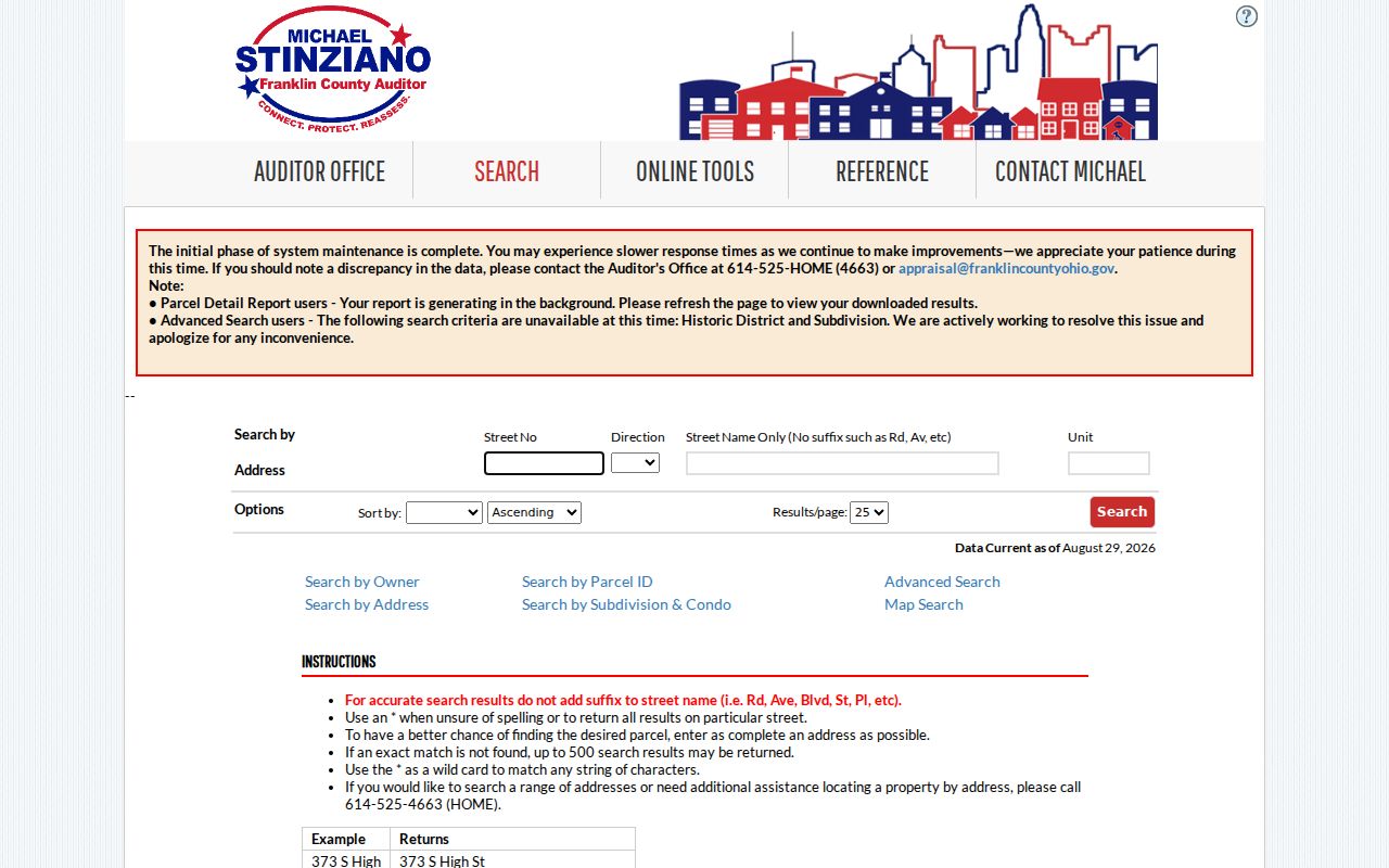
Use the resulting parcel page to keep the property location and tax-contact information in their own columns before moving to a recorded document search.
Whole-Street Searches in Jackson Township
Insider tip. The Auditor instructs users to omit road-type suffixes and permits the * wildcard for a complete named-street query. A street directory search can therefore begin broad and then be narrowed by number, direction, unit, or individual parcel. The portal warns that a nonexact result set may reach 500 entries, so a broad result should be treated as a work list rather than a finished answer.
Parcel ID search is the next useful narrowing tool. It accepts all or part of the identifier without dashes and supports wildcards. That makes the ID a stronger handoff than copying a name from one street result into another source.
The Auditor parcel-ID search is illustrated below after an address result supplies the identifier.
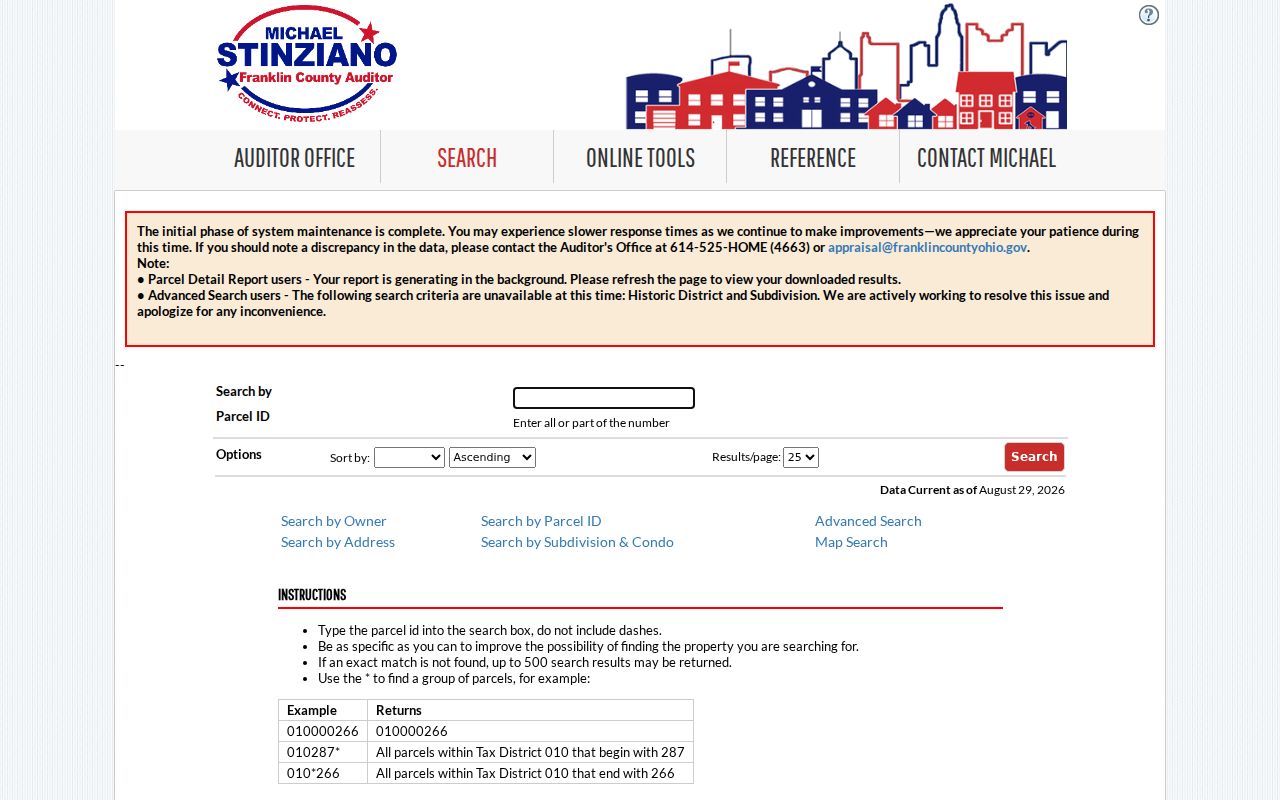
Parcel ID results help retain the same property trail when names, mailing routes, or street formatting differ among official systems.
Jackson Township Street Directory Parcel Maps
The Parcel Viewer is a map tool, not a people finder. Its manual documents searches by shape, value, and spatial relationship. A value search can use parcel ID, subdivision or condominium name, annexation, or special tax district. A spatial search begins with a parcel, adds a distance, then offers buffer controls with inside or intersecting selections.
Use Identify to inspect one or more mapped features and follow its link to the detailed property record. The layer list, legend, aerial or street basemap, and scale all affect what is visible. The results menu can export a CSV parcel list, which is useful for comparing public parcels along a segment without treating that list as a list of residents.
The Auditor advanced map search provides another visual route into Jackson Township parcel work.
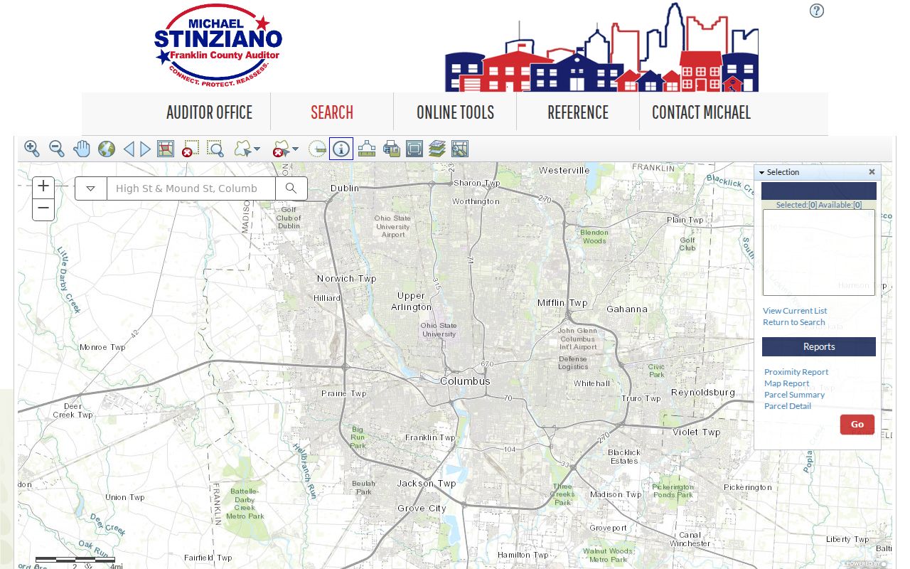
Map geometry can explain why adjoining parcels have nonconsecutive street numbers and why a careful street directory search needs both the map and the property card.
Deed Trails in Jackson Township Street Records
Once the parcel and legal description are known, Recorder Cloud Search supplies the document trail. Its Advanced Search accepts party names, grantor, grantee, recorded date range, document types, document numbers, book or volume and page, OCR phrases, subdivision legal, and freeform legal criteria. Add the party name as LASTNAME FIRSTNAME, then narrow by deed type or the legal description when a simple name produces too many results.
A current grantee may lead to a purchase deed. The document identifies an earlier grantor, who can then be searched as a grantee in an earlier transaction. Keep the recording date, document number, and book or volume and page with each result. Deeds, plats, releases, liens, and related instruments describe recorded relationships and dates, not an uninterrupted statement about who occupied the property.
For an old street trail, the Recorder directs researchers to its 1804–1913 handwritten deed-index process. Search by grantor or grantee, locate the index page, and use the volume and page reference to retrieve the transaction. Some earlier records were lost in the 1879 fire, although the Recorder says most were reconstructed.
Jackson Township Street Directory Record Coverage
Address-keyed records answer different questions. Combining them helps verify a specific property event, but none of the rows below establishes a full household at a street location. Start with the record that matches the question and retain the date of each result.
| Address record | Custodian | Useful fields | Access route |
|---|---|---|---|
| Parcel record | Franklin County Auditor | Owner, mailing/contact address, site address, parcel ID, legal description | Property search, counter, or phone assistance |
| Tax-property record | Franklin County Treasurer | Name, street-address, or parcel tax context | Property search or Treasurer records channel |
| Recorded land document | Franklin County Recorder | Parties, instrument type, date, document number, legal description | Cloud or legacy search and Recorder counter |
| Parcel map | Auditor GIS | Boundary, selected parcels, layers, identify result | Parcel Viewer and its documented tools |
| Township property action | Jackson Township | Known permit, zoning, hearing, code, or map record | Specific request to the Township |
The Treasurer property search gives a separate name, street-address, or parcel-ID tax channel.
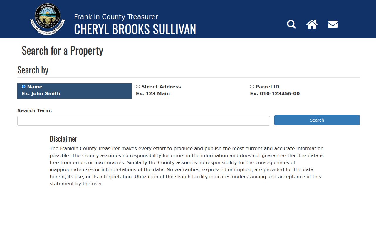
Treasurer results can corroborate tax-bill context, while the Auditor property card and Recorder instruments remain the more direct parcel and document sources.
Jackson Township Street Directory Terms
Street records use terms that look similar but describe different things. Recording these fields separately prevents a mailing route or abbreviated address from being mistaken for a property location or a past household result.
- Parcel
- A defined piece of real property in the Auditor inventory, identified by a parcel ID and mapped boundary.
- Situs address
- The property location shown on the parcel record. It is distinct from an owner or tax-contact mailing address.
- Plat
- A recorded map or subdivision layout that can connect lots and legal descriptions to a street area.
- Criss-cross directory
- An address-arranged directory section used to locate a dated occupant clue, if the selected volume actually covers the area.
A site address may remain useful for map searching even when older documents rely on a lot, subdivision, metes-and-bounds description, or book and page reference instead.
Jackson Township Street Directory Requests
Jackson Township has address-linked zoning, planning, and fire-prevention materials, but research found no general public portal for searching every permit by address. For a known property action, send the Township a specific request with the address or parcel, approximate date, record type, and any case or permit number. The Township Administrator and Zoning Department are the local fallback for bounded records rather than a substitute for county land records.
For road, plat, or address-continuity questions, the Franklin County Engineer maps and records page describes township maps, road record books, plats, surveys, right-of-way plans, and historic maps dating to 1842. Ask for a named road, plan, section, or date when a modern street label does not reconcile with an older record.
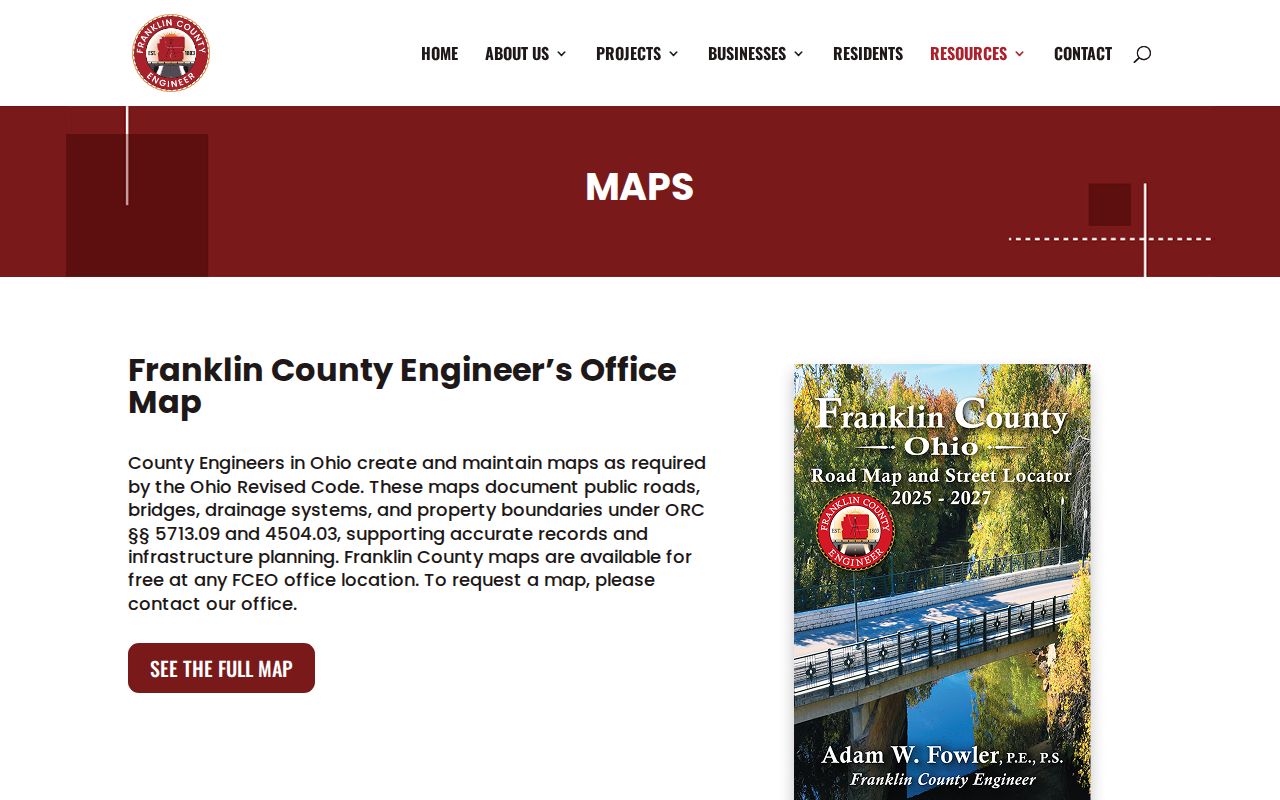
Engineer records can resolve road and plat context; they do not turn a street map into a current occupancy record. Dated historical directory collections are described separately in the Jackson Township city directories.
Jackson Township Street Directory Voter Limits
Ohio voter records have a public and confidential boundary. The statewide search requires a first name, last name, and county before offering a conditional street-name narrowing step. Franklin County also provides address-based polling and district tools. Neither route is a browseable list of all voters along a Jackson Township street.
ORC 3503.13 and related rules exclude protected identifiers and qualifying protected addresses from public display. Publicly useful voter information must not be used to infer ballot choices or to assemble a streetwide household list. Use the Franklin County voter information search for its stated registration and polling functions, then verify any separate record with its custodian.
Jackson Township Street Directory Boundaries
Myth. A name beside a parcel or a mailing address does not prove present occupancy. The Auditor deliberately distinguishes owner mailing or contact address, site address, and legal description. Recorded deeds identify parties to a transaction. A source may be accurate for its own date and purpose while still being incomplete for a question about who lived at a location.
Lawful use. Use Jackson Township street records for personal, civic, family-history, estate, property, or safety questions, and verify important details with the custodian. Do not use them to stalk, harass, threaten, or expose a protected address.
Public sources do not reveal all household members, private utilities, protected-program participants, motor-vehicle addresses, or every person receiving mail. Safe at Home and voter protections can limit records. A missing name or permit is not proof that a person was or was not connected to an address.